Oldmixon, John
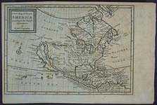
The British Empire in America Containing the History of the Discovery, Settlement, Progress and State of the British Colonies on the Continent and Islands of America. London, 1741. Two volumes. 567 pp.; 478pp. plus eight folding maps. This contemporary calf, binding is expertly rebacked in uniform contemporary style, with spines gilt and leather labels. The map of North America is detached.


This two-volume set served as a basic eighteenth-century reference work on British America. This is the second edition, considerably enlarged and expanded from the first edition of 1708. In his introduction to the work, Oldmixon states the common arguments against the colonization of America and offers assertions of the advantages colonization would have for England. The first volume is devoted to the North American colonies and includes maps of North America, the supposed islands of Canada, New England, Virginia and Maryland, and Carolina and Bermuda.
The second volume describes the British colonies in the West Indies and contains maps of Barbados, Jamaica, and St. Kitts and Antigua. Any Englishman of the time would have found this important work as the first point of reference for information on "the islands of America." In his discussion of the discovery and colonization of Florida, Oldmixon writes that the coast of Florida was first discovered by Sebastian Cabot about the year 1500, thought Oldmixon retorts that "it does not appear in any authentick Historian that Sebastian Cabot got that far South." He continues with the discoveries of Ponce De Leon and other Spanish explorers. Spain was discouraged by several failed exploration attempts and the French made some discoveries in the northeast portion of the state. Oldmixon provides an account of the "War of Augustine," where members of the government of Carolina attacked the Spanish fort at St. Augustine. The attempt to take the fort failed and the end result was a huge debt for the Province of Carolina. Oldmixon also discusses the various attempts to colonize the area. Florida "was granted by King Charles I to the Earl of Arundel; which grant 60 years ago, was assigned to Dr. Daniel Cox, and he was the Proprietary. He gave it the name Carolana; and in King William's reign sent two ships thither, with 200 People, over who Sir William Waller was to have been Governor. The first colonization attempt failed due to French claiming the area."
John Oldmixon was a member of an ancient family, which settled at Axbridge, Somerset, as early as the fourteenth century, and afterwards held the manor at Oldmixon, near Bridgewater. In 1696, Oldmixon published a collection of poems and in the next few years he produced a great deal of poetry and drama. Oldmixon's work as a historian began in 1708 when he published this two-volume history of British interests in North America. He continued in his role as an historian and published works about Europe, France, and England, as well as several biographies of well-known personalities in English politics.
The maps in the volume were drawn by Herman Moll, a Dutch cartographer residing in London. Moll was highly regarded for his cartographic skill, and his maps of North America were used by the British government to support British claims in its boundary disputes with France following Queen Anne's War. Regarding Spanish Florida, Moll reasserted the Carolinian claim to the northern portion of the peninsula by giving the southern boundary of Carolina as 29 degrees in conformity with the 1665 provisions of Charles II's Royal charter. This earlier charter placed the city of St. Augustine well within the boundaries of English Carolina. Moll's implication was that the British already had virtual control of Spanish Florida, and that eventual British ownership of Florida was a real possibility.