
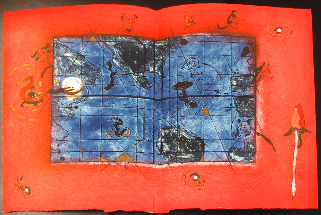
This map shows both Columbus’ actual journey to the West Indies and the journey he thought he was undertaking to the East. These paths are indicated by stippled lines that run across the map horizontally. The line that travels across the Atlantic and ends up in the Caribbean islands represents the route that Columbus sailed in 1492. The other line travels past the Caribbean and onward to China, although this route was never possible. Note the geographical irregularities of the map: Central America does not exist and North and South America are too far apart. The artist imagined that prior to his 1492 voyage, Columbus could have been tricked into buying a secret map like this one showing a path to China by sea.
The Chinese lettering in the lower right corner of the map reads “Secret Map.” In color and layout this map appears to have been inspired by placemats in modern Chinese food restaurants, many of which display the animals of the Chinese zodiac. A number of these animals are also pictured here.
 |