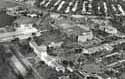
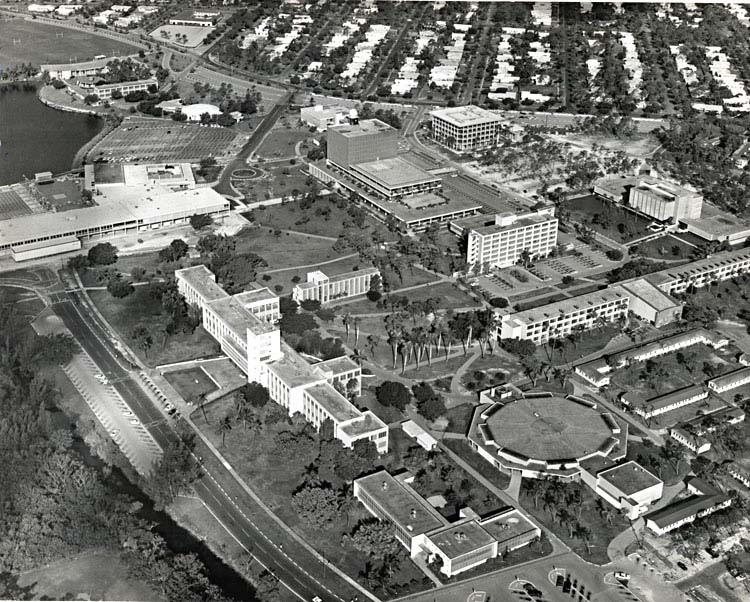
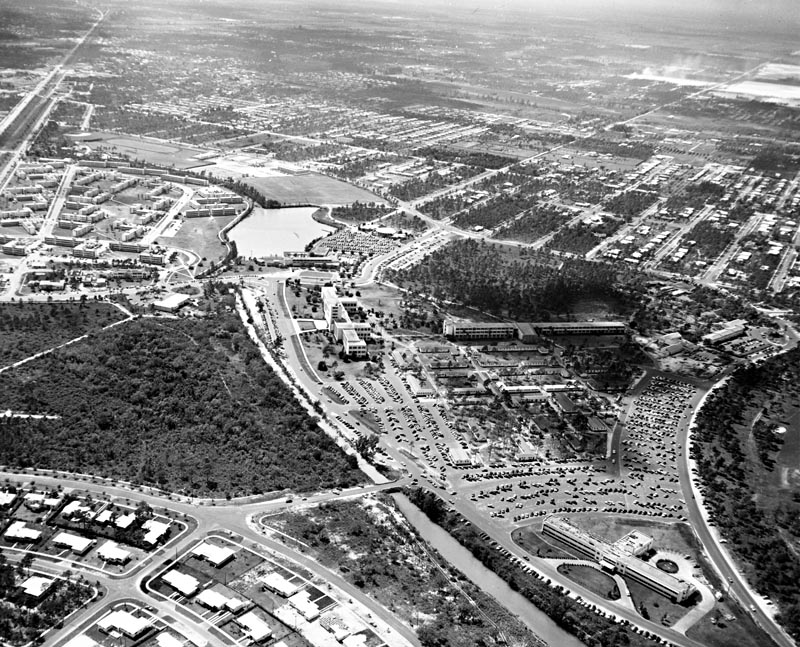
-Click image to enlarge- | Aerial of Coral Gables Campus Including Richter Library
The newly opened Otto G. Richter Library stands in the upper center area of the photograph, which was taken in the mid-1960s. In the 15 or so years since the first buildings appeared on campus, a great deal of development and construction was completed. The James M. Cox Jr. Science Building, completed in 1967, will be the next to appear, located in the space directly behind the library.
|
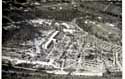
-Click image to enlarge- | Aerial View of Coral Gables Campus
This aerial view, taken in the mid-1940s, includes the skeleton of the Merrick Building and the newly completed Memorial Building. The L-shaped buildings in the foreground were constructed quickly to house the great influx of new students following World War II. These temporary buildings, affectionately known as the "Shacks," housed classrooms and administration offices for many years.
|
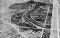
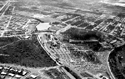
-Click image to enlarge- | Aerial View of Coral Gables Campus, 1926
Aerial view of the Coral Gables campus in 1929 as it looked from 1926-1946. The Merrick building skeleton and the Don Carlos apartments (now the Student Health Center) in the center top were the only buildings on the site.
|
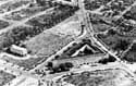
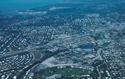
-Click image to enlarge- | Aerial View of North Campus
Due to financial set-backs, construction of the Merrick building was halted in mid-1926. To open on time, the founders turned to a partially completed hotel, the Anastasia (foreground) and in 1939 to its sister building across LeJeune Road, the San Sebastian (upper center). The University operated from these buildings until the Memorial classroom building was completed in 1946. (photo taken in 1935)
|
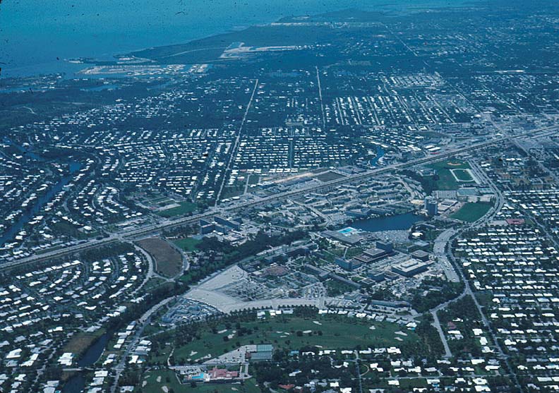
-Click image to enlarge- | Aerial View of the Coral Gable Campus
An aerial view of the Coral Gables campus looking toward Biscayne Bay in the early 1960s.
|
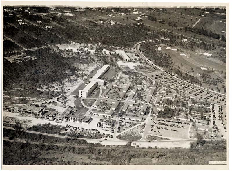
-Click image to enlarge- | Aerial View of the Coral Gables Campus, circa 1967
The Coral Gables campus, looking toward Biscayne Bay, is pictured in this aerial photograph, probably taken around 1967. The James M. Cox Jr. Science Building is nearing completion and the ground is broken for the '68 Towers, now known as the Hecht Residential College.
|
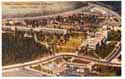
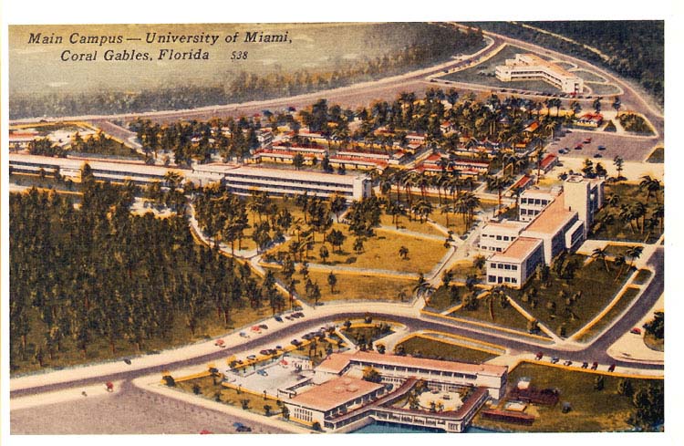
-Click image to enlarge- | Aerial View of the Coral Gables Campus, early 1950s
This postcard provides an aerial view of the Coral Gables campus of the University of Miami. Bottom, Student Club on the shore of the University lake, with outdoor dance and dining loggias; right, Merrick Building; left, Memorial Classroom building and Beaumont Lecture Hall; upper right, Doctors Hospital; top, Riviera Country Club and golf course.
|
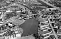
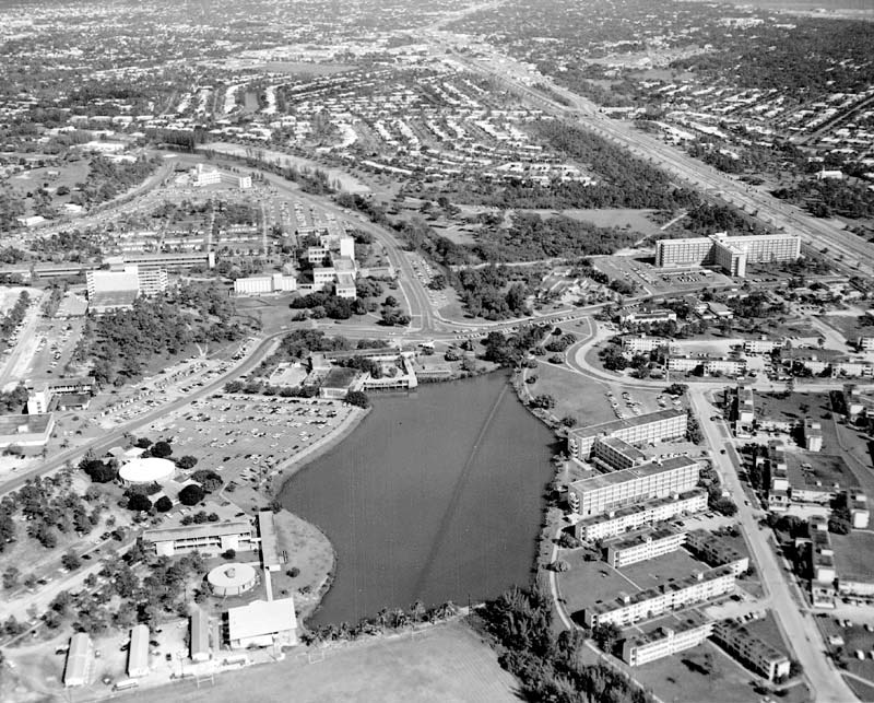
-Click image to enlarge- | University Lake (Lake Osceola)
This aerial view of the Coral Gables campus taken in the 1950s includes the University lake. A small natural lake at this location was dredged in 1947 to create a larger man-made lake. The dirt and rock dredged from the lake were used in the construction of the Rickenbacker Causeway to Key Biscayne. Lake Osceola was named in a secret ceremony by Iron Arrow. Since Iron Arrow's activities are based on Seminole Indian traditions, the lake was named in honor of Osceola, the great Seminole chief. More information
|
|
