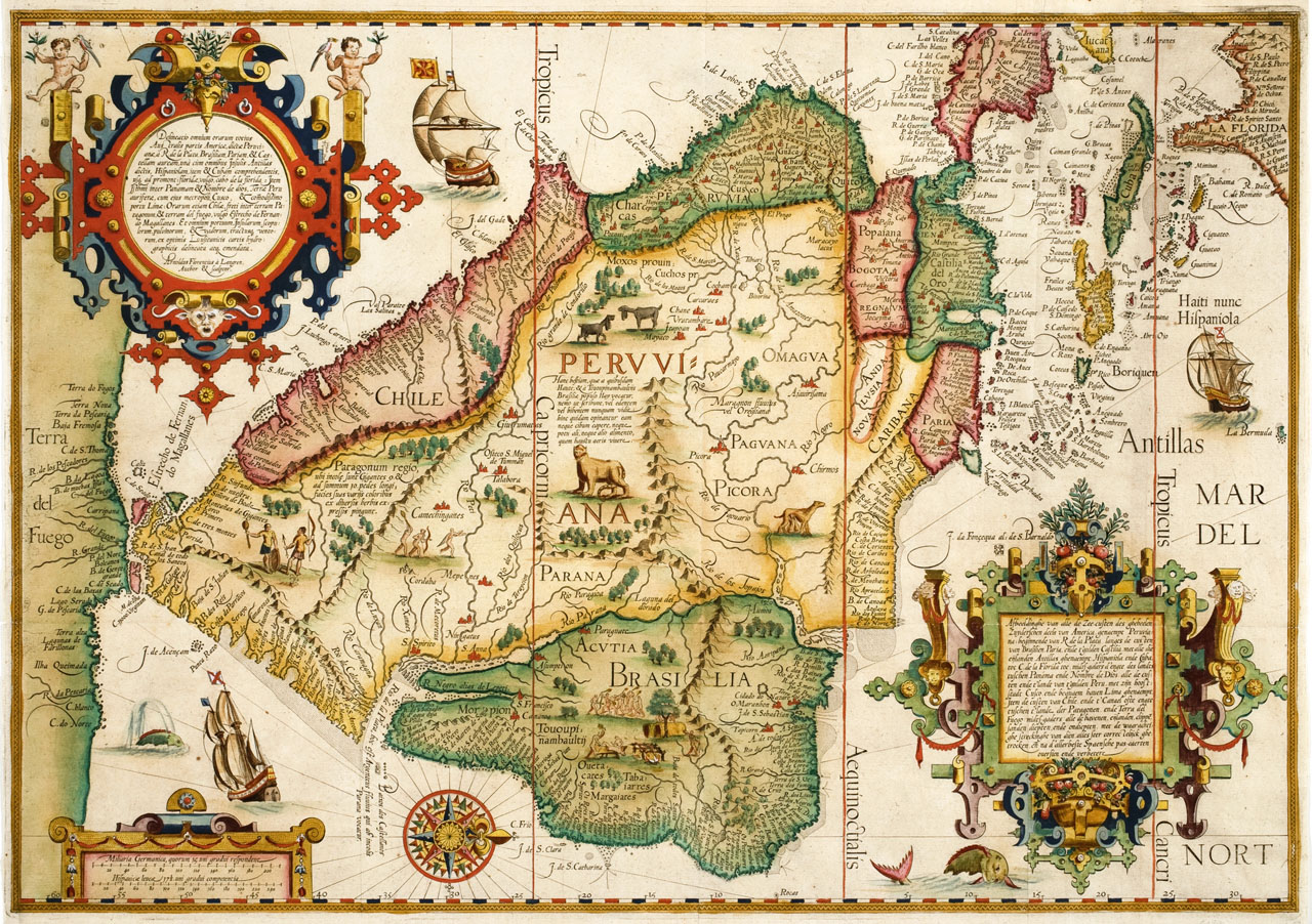
Delineatio omnium orarum totius Australis
, Amsterdam, 1596.
Click image to enlarge.
By Langren, Arnoldus Florentius á (ca. 1571-1644).
Langrens peculiar map situates north to the right side and features South America, the Caribbean, Florida, and a supposed southern continent named Terra del Fuego. Ornate decorations include illustrations of ships, animals, and two large cartouches on the upper left and lower right corners. The map is based on Iberian sources and Portuguese portolan charts, and appears in Jan Huygen van Linschotens famous Itinerario... (1596). The van Langren family were prominent Dutch cartographers in the late sixteenth and seventeenth centuries.
From The Helen Carmichael Purdy Foundation.