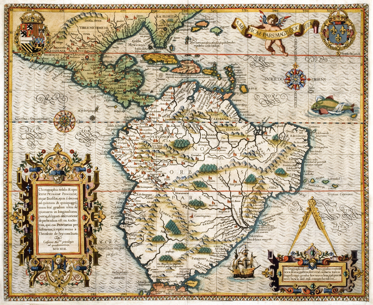
Americae Pars Magis Cognita, Frankfurt, 1592.
Click image to enlarge.
By De Bry, Theodoro (1528-1598).
This vivid, rare map features what are now the Southern United States, Central America, and South America. Intricate designs include two decorative cartouches on the lower left and right corners, a ship, a whale, two compass roses, a coat of arms, and a cherub holding a scroll. The map appears in the third part of de Brys Grand Voyages, which provides travel accounts of Johann van Staden and Jean de Lery during the 1540s and 1550s. The Florida peninsula is based off Jacques Le Moynes cartography, and the coast of Chile features an exaggerated bulge that was discontinued in Abraham Orteliuss cartography in 1587.
From The Helen Carmichael Purdy Foundation.