Florida/ Bahamas/ Cuba.
Bishop, Capt. Robert/ LAURIE & WHITTLE [London 1761/1794] An Accurate Draught of the Gulph-Passage from Jamaica with the West End of Cuba Etc, Humbly Dedicated (by Permission) to the Right Honourable the Lords Commissioners of the Admiralty By their Lordship Most Obedient Servant Robert Bishop. Engrav'd by Eman: Bowen. Published 12.th May, 1794, by Laurie & Whitle, No. 53 Fleet Street, London. [Original imprint, in Florida on chart:] Publish'd by the Author May 20, 1761. According to Act of Parliament, and Sold at the Jamaica Coffee House in St. Michaels Alley Cornhill London. 27 3/4 x 3/4 inches
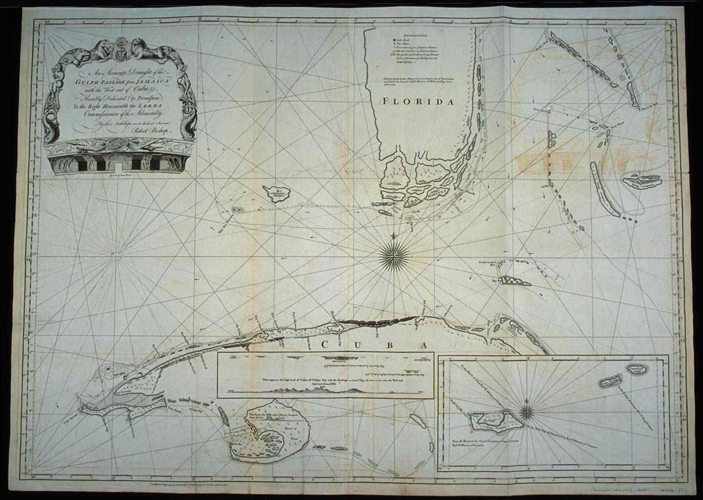

This is an extremely rare English chart of the water between Florida and Cuba and of the Bahamas, showing the lower part of the Florida peninsula and much of Cuba. This chart does not appear in Sellers and Van Ee's guide to maps in the Library of Congress. The map is also not included among the contents of atlases by Laurie and Whittle listed in Phillips and in the National Maritime Museum Catalogue. The only reference found to Bishop is in Tooley's Dictionary of Mapmakers, which does not note this work. The entry for Captain Robert Bishop notes that he was a hydrographer and had produced Windward Passages from Jamaica in 1761 and Old Straits Bahamas, 6 charts, in 1794-1796. A search of the holdings of the British Library indicated that the chart was published with two others of adjacent areas. No other information concerning Captain Bishop has yet to emerge.
A clue possibly explaining the rarity of this work is provided by the imprint for the original issue of the chart, given as May 20, 1761, and located in Florida on the chart. Here it noted that the chart was self-published ("Publish'd by the Author"). The chart could therefore have been part of a brief, unsuccessful foray into chart publishing and selling by Captain Bishop. (No known copy of this 1761 issue of the chart exists). Another possibility is that Captain Bishop never existed and was invented by the publishers as a marketing ploy. Laurie and Whittle ascribed some charts of the American coastline to a Captain N. Holland who most scholars also believe was an invention.
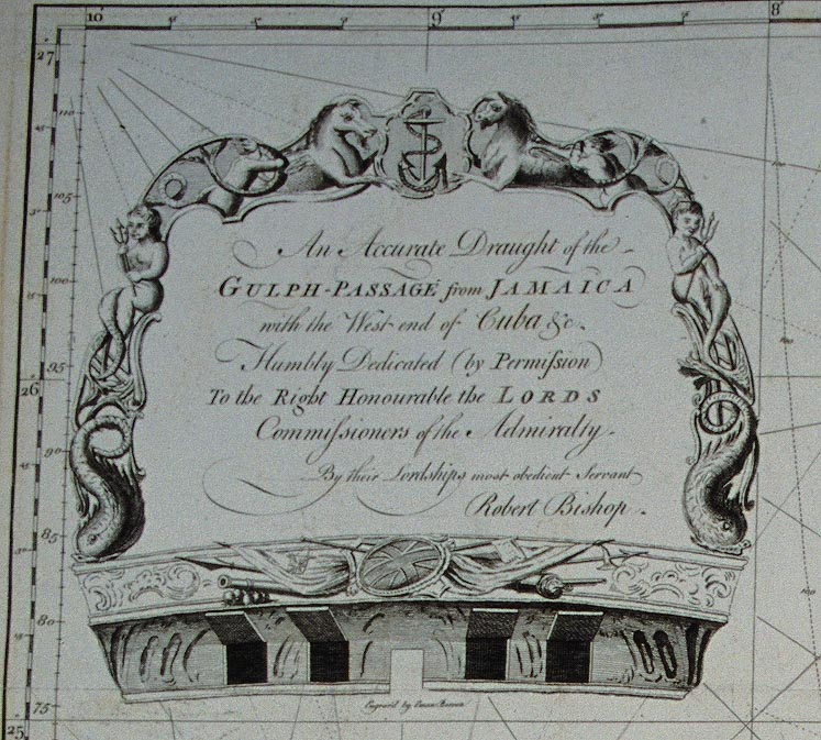
Bishop or whoever published the chart did secure the services of the highly esteemed engraver, Emmanuel Bowen, who created for it one of the most striking cartouches to be found on an English map of the second half of the 18th century. In the shape of the stern of a ship, it artfully links assorted nautical detail. The text of the cartouche is as follows:
An Accurate Draught of the
GULPH-PASSAGE from JAMAICA
With the West-end of Cuba &c.
Humbly Dedicated (by Permission)
To the Right Honourable the LORDS
Commissioners of their Admiralty
By Their Lordships most obedient servant
Robert Bishop
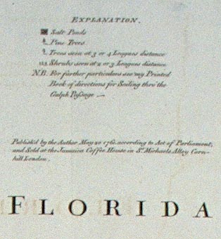
An explanatory key to various landforms was also included. The key is centered on the landform of Florida and designates symbols for Salt Ponds, Pine Trees, and Trees and Shrubs visible from two to four leagues distance. The symbols denoting these physical features can be seen on the east coast of Florida and on the various islands. In an added note, Bishop directs the reader: "For further particulars see my Printed Book of directions for Sailing thro' the Gulph Passage. Instructions and Observations Relative to the Navigation of the Windward and Gulph Passages: as laid down in Two Large Charts appeared in 1761, also published by the author, Robert Bishop.